Our Plan to Count Shorebirds in the Colorado River Delta

A peek into Audubon’s scientific efforts to better understand a critical migration bottleneck.

By Chad Witko
Outreach Biologist, Migratory Bird Initiative, Audubon Society

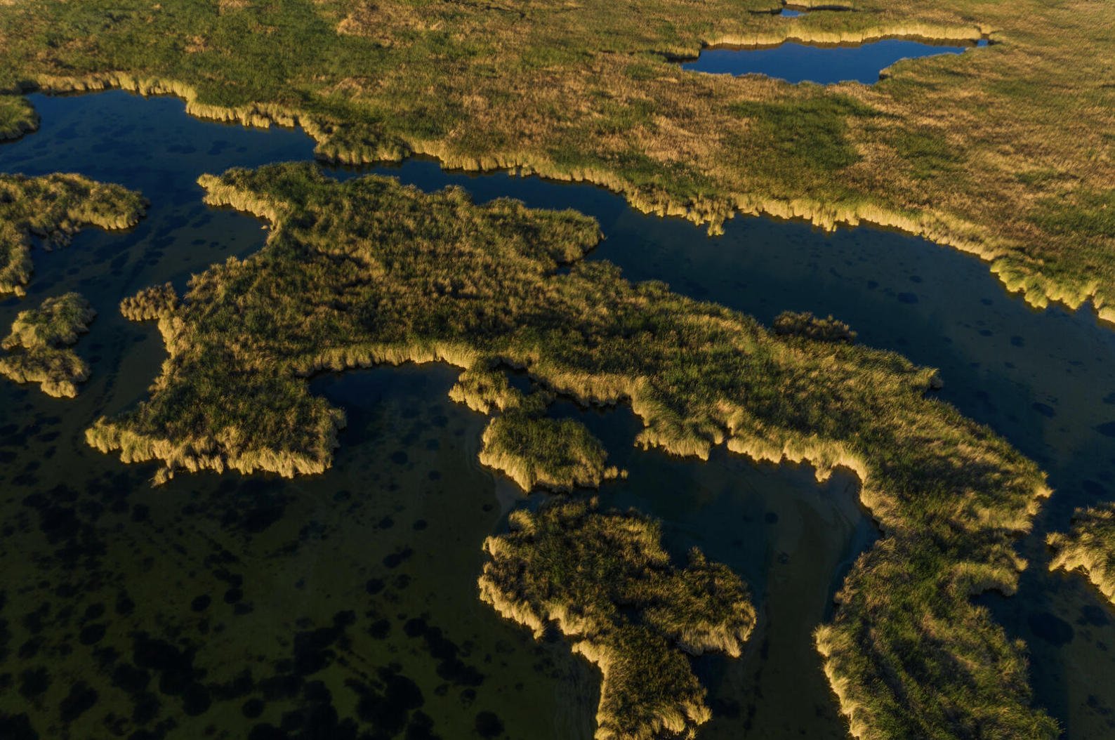
Colorado River Delta. Photo: Claudio Contreras Koob

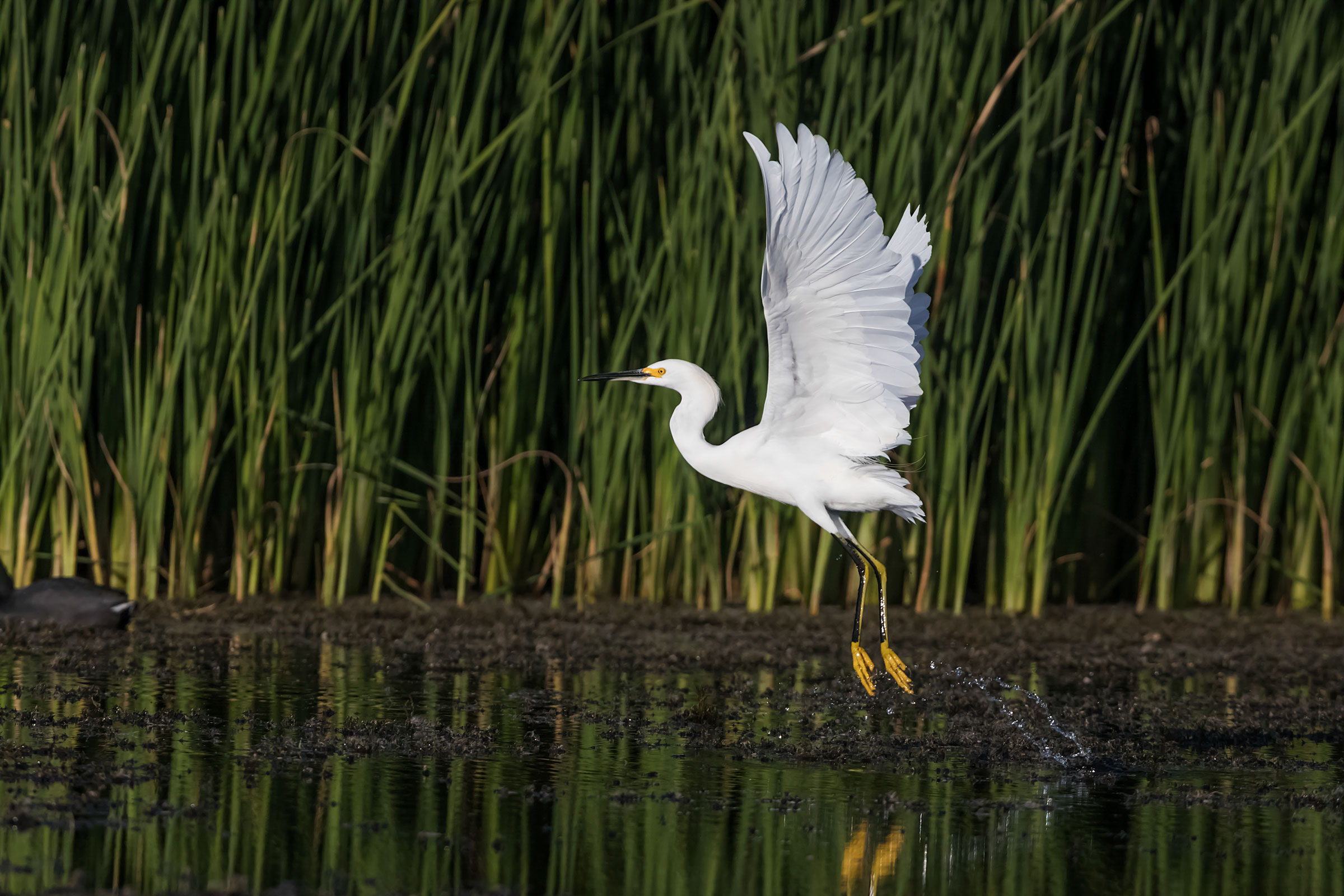
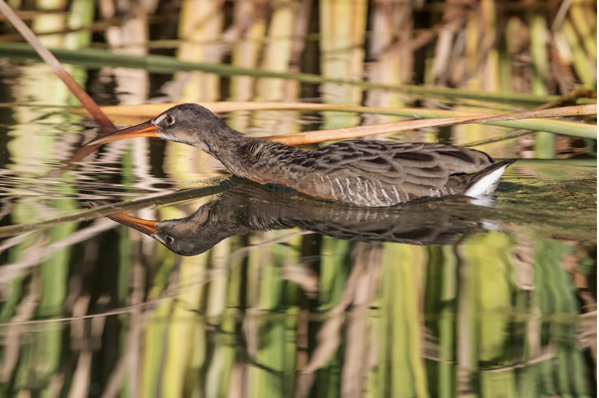
Nestled within the heart of the Pacific Flyway, nearly halfway between Alaska and Chile, the Colorado River Delta is one of the most important wetland ecosystems in the Western Hemisphere for birds. Many people also live there and rely on the river—for their homes, farms, and other businesses. Audubon’s own research, published in the journal Ornithological Applications, shows that this region of Mexico is critically important to the populations of over 100 landbird species. Millions of landbirds use the delta during migration, with some species, such as the Tree Swallow, seeing about 27% of their global population migrating through this corridor. But with its riparian habitats and expansive mudflats, the Delta is equally vital to the hundreds of thousands of shorebirds—like American Avocets, Willets, and Western Sandpipers—that overwinter here each year or migrate through to locations half a hemisphere away. Because a healthy Delta is important for the people in Mexicali Valley and essential to the survival of so many birds, and other wildlife, there are many ongoing efforts to protect and restore this area. Audubon—in partnership with the binational Raise the River coalition and federal and university partners in the United States and Mexico—is working to restore the Colorado River Delta and its associated wetland ecosystems.

To obtain data and better understand how birds use the Colorado River Delta, Audubon and our partners at Pronatura Noroeste initiated a semi-annual aerial shorebird survey, conducted three times each spring and fall, to evaluate the impacts of water deliveries for the environment and its effects on shorebirds. This is all done within the context of Minute 323—a binational agreement between the United States and Mexico. While the study is just starting and will continue until at least 2023, we wanted to give you some insight into what we are studying.

Audubon and Pronatura Noroeste, with support from LightHawk (a non-profit conservation flying organization), conducted the first surveys of the multi-year study in 2021. These surveys, both airplane-based and on-the-ground, took place during the spring and fall migration seasons, with three surveys each season spaced approximately two to four weeks apart.

For the airplane portions of the survey, Audubon hired Jonathan Vargas Vega, a local shorebird observer, to join LightHawk volunteer pilots. The purpose and benefit of the aerial surveys are to conduct shorebird counts over large and remote areas of shorebird mudflat habitat, which make up a large portion of the Delta’s composition but are otherwise inaccessible. While counting every bird in an entire ecosystem is impossible, researchers can obtain accurate snapshots through aerial surveys, which cover large areas in a relatively short period of time.

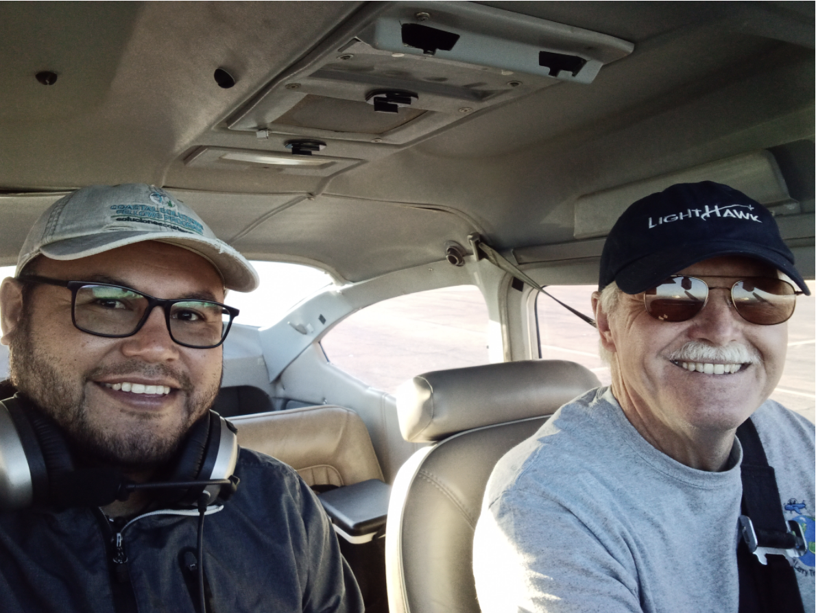
Photo of Jonathan Vargas Vega, left, aerial shorebird observer, and Bill Rush, LightHawk volunteer pilot. Photo: Courtesy of Jonathan Vargas Vega

Over time, the weight of these snapshots is compounded, providing researchers with critical insight into changes in the number, timing, and locations of migrating shorebirds. These changes can be further linked to various factors including water management, habitat loss or restoration, and climate change.

As our quantitative ecologist Tim Meehan put it, “Getting a birds-eye view of when, where, and how many shorebirds are using the Delta will help us evaluate the effectiveness of ongoing water policy and habitat restoration work being conducted by Audubon and its international government and NGO partners. This work both creates a solid baseline for evaluation and serves as a measure of how things improve as work is conducted.”

For the aerial surveys, planes departed from the Mexicali International Airport in Baja California, Mexico, and flew over the same pre-determined flight-line across the Delta. Partners of the study and local collaborators established priority areas for flights with a particular focus on two areas: along the main stem of the river that is affected by instream flow management and site-level habitat restoration, and within the Cienega de Santa Clara, the largest remaining wetland in the Colorado River Delta.

During these flights, the expertise provided by LightHawk’s volunteer pilots really shines.

The goal is generally to fly as low and slow as possible, giving the observer the ability to identify, count, and record the shorebirds, which under normal conditions on land are difficult enough to identify. During the aerial surveys, from within the plane, the observer records shorebirds to species whenever possible. When unable, shorebirds are identified to the most appropriate taxonomic grouping (e.g., small plovers, yellowlegs, peeps, and phalaropes) or by size (e.g., small, medium, large). When conducting these surveys habitat matters, especially when it is tied to water levels and pulse flows. In addition to shorebird totals, the aerial observer also estimated the percent cover of surface water, vegetation, mudflat, and bare ground at each of the count locations where shorebirds were present.

As Vargas and various LightHawk pilots—Bill Rush, Will Worthington, and Ray Lee—flew the transect, perfectly timed with the neap tide to improve the rate of success, three to four Pronatura Noroeste ground crews simultaneously surveyed shorebirds from land across ten sampling units. Unlike with an airplane, ground surveys are limited to locations accessible by automobile or, at times, small boats, which were employed during these surveys for a few locations. As with the aerial portion of the survey, habitat variables were measured at each site from the ground and included the percent of flooded, vegetated, and bare ground. One of the benefits of running ground surveys concurrently with the aerial surveys is that the surveys from land can support and bolster the aerial observations where they overlap by providing increased accuracy in count numbers and more precise information on bird taxonomy.

The flight route local shorebird observer Jonathan Vargas Vega, with the assistance of LightHawk, took over the Colorado River delta. Map: Joanna Grand/Audubon

During the three spring surveys of April and May 2021, approximately 31,000 shorebirds across ten species were counted from the air, with most falling within the small shorebird category, unable to be identified to species. Identifying shorebirds is difficult! From a plane, with no binoculars, it can be nearly impossible. While less numerous, some of the more regularly identifiable shorebirds identified from the air, likely owing to their larger size, include American Avocet, Willet, Long-billed Curlew, and Whimbrel.

Across the three fall surveys in 2021, we counted approximately 33,000 total shorebirds. These fell across seven identifiable species and several categories of shorebirds, with the small shorebird species once again representing the highest abundance, followed by large shorebirds (e.g., avocets, curlews) and those that would be considered medium-sized species.

With six surveys completed, three each for the spring and fall of 2021, this research is just beginning. We’ll do the same counts in 2022 and 2023, and hopefully several years beyond that. Nevertheless, they are beginning to paint the picture of shorebird presence and habitat use within the Delta.

“The initial surveys provide a baseline,” Meehan said. “We get to know how many birds there are, and where they are spending their time. By comparing locations where birds are more or less abundant, we start to get a picture of what the birds value for habitat.  The real power comes after, say, a decade of counts. This allows us to look variation in bird abundance over both space and time. By looking at variation over space and time, we have more confidence in our conclusions and get to learn about how birds respond to conservation actions.”

These surveys also reflect the importance of multi-national partnerships for studying and conserving species that are hemispheric migrants. For shorebirds that breed in the Arctic and winter in Chile, there are no such things as geopolitical boundaries. If we want to protect them for generations to come, we must do our best to remove those boundaries through collaborative partnerships across the hemisphere, on their breeding and wintering grounds, and at important rest stops along their incredible annual journey.


Restoring the Colorado River Delta

How building binational support brought water, trees, funding, and birds back to the Colorado River Delta.

By Jennifer Pitt, Colorado River Program Director, Audubon
Verdin. Photo: Lisa Langell/Audubon Photography Awards

Today, the United States and Mexico, through the International Boundary and Water Commission (IBWC), released an implementation report documenting the first environmental progress under Minute 323, a binational Colorado River agreement adopted in late 2017. The report documents more than $3 million spent and nearly 7,000 acre-feet water delivered for habitat restoration during the first year of the agreement. The story behind these numbers is remarkable.

First, there’s the fact that restoration is taking place at all. Not long ago, the United States and Mexico were locked in a bitter battle over Colorado River management, disputing lining of a canal that saved water for the United States and depleted water availability in Mexico. Today the two countries are collaborating to put habitat back in the Colorado River Delta—an extraordinary success of diplomacy that stands out at a time when U.S.-Mexico relations are otherwise fraught.

Throughout the 20th century, both countries developed water for farms and cities that desiccated the Colorado River Delta throughout its 250,000 square mile watershed. A vast expanse of wetlands and riparian forests disappeared as the river ceased to flow through its final hundred miles towards the sea.

Now, more than 1100 acres thrive with native trees and wetlands vegetation. In 2018 alone, restoration crews cultivated more than 50,000 native plants in on-site nurseries before planting them—significantly hard labor in the desert sun.

It takes extraordinary effort to make this landscape bloom again. Hard-working non-governmental organizations (NGO) restoration crews spend countless days in the hot sun preparing lands and planting trees. An NGO environmental water trust cooperates with the vast Mexicali Irrigation District to ensure those trees are watered. A binational team of scientists travels the area repeatedly to collect data on the ecological and social impacts so that the effort might improve in the future. An impressive, binational collection of organizations, including federal and state agencies, NGOs, and universities work together to coordinate the work and ensure dollars and water are available to support it.

We know from past monitoring reports that birds are returning—species diversity is 27 percent greater and populations are a stunning 80 percent greater in restored sites along the Colorado River in the delta when compared to lands not yet restored. Birds recently spotted include: Albert’s Towhee, Ash-throated Flycatcher, Blue Grosbeak, Black Phoebe, Black-tailed Gnatcatcher, Cactus Wren, Crissal Thrasher, Gila Woodpecker, Hooded Oriole, Ladder-backed Woodpecker, Song Sparrow, Vermillion Flycatcher, Verdin, Western Kingbird, and Yellow-breasted Chat. We expect more good news when the IBWC publishes the next monitoring report later this year.

Originally appeared on Audubon.org, May 7, 2020

Water to Flow in Colorado River Delta Again

Canal maintenance a reminder of the 2014 pulse flow

By Jennifer Pitt, Colorado River Program Directo. Reprinted with permission from The Audubon Society

Tomorrow, water will flow again in the Colorado River along the US-Mexico border. The long-dried out channel—the final 100 miles of the Colorado River before it ends at the Gulf of California—has not seen this much water since the 2014 “pulse flow.”

However, this is brackish water. For a few months, we will see it in the Colorado River below Morelos Dam, reminding us of the river that once flowed there. It is agricultural drainage that comes from farms in southwestern Arizona that use the Colorado River to irrigate in the desert. Because these farms sit above salty groundwater, their drainwater is too saline for return to the Colorado River. The drainwater is usually sent down a concrete-lined canal that takes it on a path parallel to the Colorado River, across the border into Sonora, Mexico. There it empties into the Ciénega de Santa Clara, the last great wetland of the Colorado River Delta.

But the nearly 50-year-old canal is badly in need of repair. So the U.S. Bureau of Reclamation (Reclamation) will close it temporarily, and with nowhere else to put the brackish water (which cannot be used for farming, or even for swimming), they will divert it back into the Colorado River, below Mexico’s diversion at Morelos Dam, where it does not mix with Mexico’s water supply.

Repairs to the canal will extend its life, which is a good thing, because the Ciénega and the birds that call it home rely on this water. When first built, the canal’s terminus was dry mudflats, land that was once the eastern extent of the lush Colorado River Delta ecosystem of nearly two million acres. When the Colorado River Delta went dry, that entire ecosystem shriveled. The canal was not designed to resurrect delta wetlands, but inadvertently it did.

Today the Ciénega de Santa Clara is a watery and green expanse, standing in extraordinary contrast to the Sonoran Desert that surrounds it. It harbors hundreds of thousands of birds, including the world’s largest remaining population of Yuma Ridgway’s Rail, an endangered species. On a visit you can see long lines of White-faced Ibis in flight, squadrons of pelicans, ducks and cormorants by the hundreds. It is a spectacular oasis, 40,000 acres protected in Mexico as a Biosphere Reserve.

Scheduled repairs mean the canal must sit dry for 3-4 months. In the short term, the Ciénega de Santa Clara is deprived of that water supply. Migrating waterfowl are not present in the fall, although resident and partially-resident species like the Yuma Ridgway’s Rail will be impacted. Fortunately, the disruption to flows will be relatively short-lived, and the United States has funded a binational team that includes Audubon scientists to document the impacts and the recovery. The monitoring effort has been coordinated with the International Boundary and Water Commission, and includes scientists from both the United States and Mexico.

However, a more serious threat to the Ciénega de Santa Clara looms. If operated, the dormant Yuma Desalting Plant could divert the canal’s flow on a more permanent basis. Reclamation might do that to increase water reserves in Colorado River reservoirs. In the wake of the 2019 Lower Colorado River Drought Contingency Plan, that is a real possibility as it commits Reclamation to work on approaches to find 100,000 acre-feet of water (about 100,000 football fields in water one-foot deep) annually. Finding “new” water is a tall order for an agency that does not have a Colorado River allocation. The desalting plant would deplete the water in the canal, replacing it with super-salty brine waste. That would be a double-hit to the Ciénega de Santa Clara, severely reducing both quantity and quality of the water that sustains it. The wetlands and the birds that call it home would be devastated. Because the United States and Mexico do not yet have a treaty agreement to protect the Ciénega de Santa Clara’s water supply, the threat is real.

Fortunately, Reclamation has alternatives. The agency is already implementing infrastructure improvements and other programs that can help, and there is more that can be done. Rehabilitation of faltering pumps, improved operations of existing infrastructure, and paying water users to conserve could create just as much “new” water—and for far less cost.

In the meantime, water will flow in the Colorado River Delta. Though the drainwater is not safe for human contact (both the United States and Mexico have posted warnings), and is too salty to help the few native trees that grow riverside, it is an important reminder that this river needs water.

Back in 2014, the United States and Mexico, in accordance with a binational agreement (Minute 319), created a “pulse flow” in the Colorado River Delta to simulate, at a small scale, the spring flood that once took place every year. The pulse flow was celebrated near and far as an unprecedented nod from the governments, that nature and local communities were worthy beneficiaries of a flowing river. It was an infusion of life-giving water that – at least temporarily – created habitat for hundreds of species of birds, and the return of the river to the sea.

In a successor agreement signed in 2017 (Minute 323), the United States and Mexico committed again to send a modest—but ecologically significant—volume of Colorado River water for the environment into the Delta. While cooperative planning is underway, their water has not yet been delivered, and it must soon.

The canal repair reminds us of what is at stake, including a Delta ecosystem that still needs water, communities that mourn the loss of the river in their midst, and a large wetlands oasis sustained by an uncertain water supply. Can the United States and Mexico commit to provide water to these last remnants of nature in the Colorado River Delta?

Bird Abundance Increases in Colorado River Delta after 2014 Pulse Flow, New Report Says

U.S.-Mexico Colorado River collaboration leads to 20% increase in bird abundance.

Collaboration between the U.S. and Mexico—supported by a coalition of nonprofits including Audubon—which resulted in a pulse flow through the Colorado River Delta, lead to a 20% increase in bird abundance and a 42% increase in bird diversity. A new study from the International Boundary and Water Commission (IBWC), which also showed an increase in greenness along the river corridor, demonstrates the importance of binational cooperation between the two countries for environmental causes. In 2012, the United States and Mexico adopted Minute 319, an innovative agreement to change how Colorado River water is managed at the border.

“The findings of the study prove that this binational cooperation was good for birds and the health of the Delta. Water temporarily reached all the way to the sea and along the way, it made the formerly dry river corridor into viable habitat,” said Jennifer Pitt, Audubon’s Colorado River Program Director. “The restoration work of our partners in Mexico resulted in nearly 300,000 newly planted native trees—creating a haven for birds and possibly future recreation sites for local communities. We’re thankful to the IBWC and the Raise the River coalition for this remarkable success.”

Raise the River is a unique partnership of six U.S. and Mexican NGOs committed to restoring the Colorado River Delta. In addition to Audubon, members include: The Nature ConservancyPronatura Noroeste, the Redford Center, Restauremos El Colorado, and the Sonoran Institute. The coalition has worked with policymakers, water agencies and governmental representatives from the U.S. and Mexico since 2012 to cooperatively create historic change for the Colorado River Delta.

Through the 5-year term of Minute 319, more than 150,000 acre-feet of water was sent into the Delta. Some of that water went directly to restoration sites to ensure the staying power of newly planted native trees. Most of the water was delivered as a “pulse flow,” engineered to mimic the natural cycle of spring snowmelt that created vast riparian forests and wetlands in the pre-development Delta ecosystem.

Now, one year after the end of Minute 319 (and the extension of its measures under a new agreement known as Minute 323), the U.S. and Mexican sections of the International Boundary and Water Commission published conclusions of a binational science team that monitored impacts, comprised of federal, university, and NGO researchers. Audubon helped lead these efforts with binational conservation partners. The science gives us lessons learned that can be applied as water is delivered and new habitat is created under Minute 323.

Included in Minute 323 were provisions to share Colorado River water surpluses and shortages, and to incentivize water conservation (especially keeping more water in Lake Mead). These measures look more important than ever as we approach the first-ever declared shortages on the Lower Colorado.

About Audubon:

The National Audubon Society protects birds and the places they need, today and tomorrow. Audubon works throughout the Americas using, science, advocacy, education and on-the-ground conservation. State programs, nature centers, chapters, and partners give Audubon an unparalleled wingspan that reaches millions of people each year to inform, inspire, and unite diverse communities in conservation action. A nonprofit conservation organization since 1905, Audubon believes in a world in which people and wildlife thrive. Learn more and how to help at www.audubon.org and follow us on Twitter and Instagram at @audubonsociety.

The Western Water Initiative is Audubon’s multi-state effort to protect the Colorado River and the West’s network of Saline Lakes. Some 65,000 members strong and growing, the network advocates for science-based, non-partisan water policies and management that benefit rivers and lakes for the birds, wildlife, habitats, cities, and economies they support. To learn more, visit: www.audubon.org/westernwater.

###

Originally published in the National Audubon Society Western Water News:

Collaboration Drives Results

A first-hand account of what it has been like being a member of the Science Team measuring the results of the 2014 Pulse Flow and subsequent water deliveries into the Colorado River Delta by Karen Schlatter.

“As a result, going forward under a new 9-year binational agreement that was signed in September 2017, water flows will be used to ensure that the people of the river have recreational and cultural benefits, in additional to the benefits to critters and plants.”

Go to Sonoran Institute Blog to read the complete story by Karen Schlatter, Associate Director, Water and Ecosystem Restorationhttps://sonoraninstitute.org/2018/collaboration-drives-results-delta-restoration/